Update 6:10 p.m.
The province is back to assessing Highway 3 about 14 kilometers west of Keremeos.
“No estimated time of opening; assessment in progress,” DriveBC states.
The next update is scheduled for 8 a.m.
Update 4:30 p.m.
Highway 3, about 14 kilometers west of Keremeos is expected to reopen at 8 p.m. Thursday, May 10. DriveBc provided that information and states another update will be coming at 7:30 p.m.
Update 11:30 a.m.:
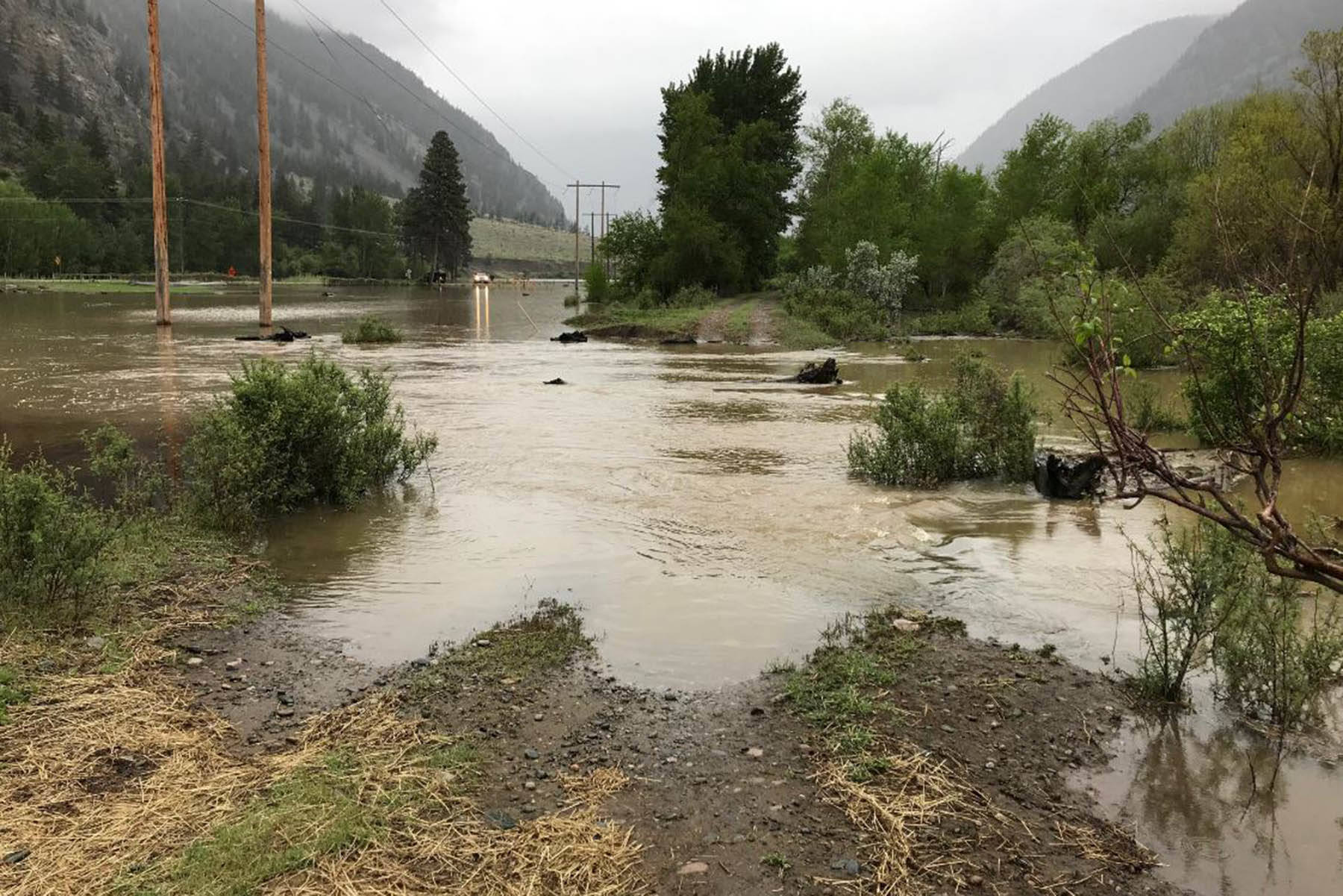
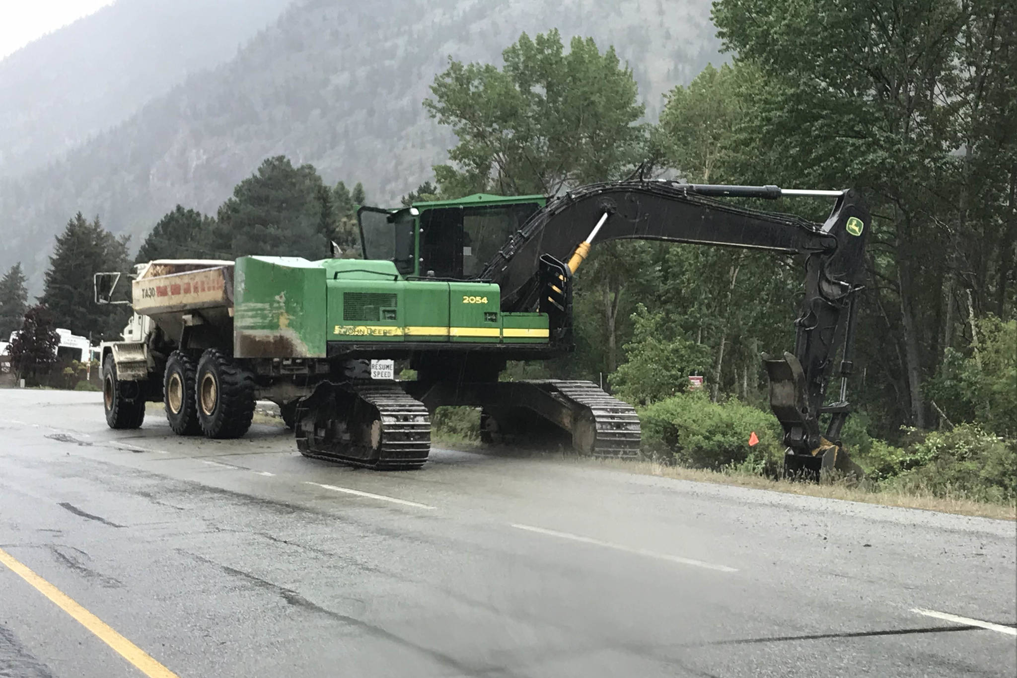
Provincial crews are working to build up low spots along Highway 3 where the flooding Similkameen River has forced its closure about 14 kilometers west of Keremeos.
“In an effort to reduce the amount of water coming over the highway, crews are working to build up low spots in the adjacent rail grade where the most of the water is infiltrating,” an emailed statement from the Ministry of Transportation and Infrastructure stated.
There were rumours on social media that Highway 3 was closed in multiple spots between Keremeos and Hedley leaving some residents with no way out. That is not true.
“There is only one closure on Highway 3. It is closed in both directions, approximately 14 kilometres west of Keremeos, due to flooding,” the ministry statement reads.
There is no estimated time of reopening, and drivers should continue to check DriveBC for updates.
Update 9:30 a.m.:
There is no estimated time for reopening Highway 3 about 14 kilometers west of Keremeos. An update at about 9:20 a.m. Thursday, May 10 said the road remans closed due to flooding of the Similkameen River. The next update will be 4 p.m.
Original:
Highway 3 about 14 kilometers west of Keremeos remains closed.
An update from DriveBC just after 6 a.m. stated the highway is closed in both directions and another update was expected at 8 a.m. The update was not complete at the time of this posting at 8:40 a.m.
Over the last few days raging waters in the Similkameen River have overflowed the banks causing water to spill over the highway and pool on both sides.
To make things worse on Wednesday a creek started to flow down the mountainside following the highway west to east and adding to the water pooled on the north side.
The highway was closed around 8:30 p.m. Wednesday night leaving many people without a way to get home.
Related: Highway 3 between Keremeos, Hedley closed
A video from local resident Tammy Allison shows how high the water was just a little while before the road closed.
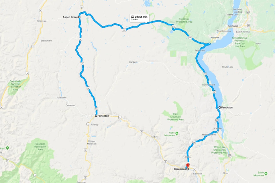
A number of people in the Keremeos area work at the Copper Mountain Mine. Those that chose to drive home were looking at an at least three hour detour having to travel 5a to Apsen Grove, which is about half an hour from Merritt, across 97C to Peachland, south along 97 through Summerland, Penticton and Kaleden to finally get on the 3A home to Keremeos.
Secondary roads including Nickel Plate and the Princeton-Summerland Road are not passable at this time. Nickel Plate Road which goes up the mountain and come out at Apex suffered at least one mudslide Wednesday and several washouts.
The Riverside RV Park, located about 500 metres from the area where Highway 3 is closed, is on evacuation alert. At least two other RV parks along Highway 3 are also on evacuation alert - Sunkatchers and Riverside Estates. Eight other properties near the river on the highway and 10th Avenue are also evacuation alert.
Related: Dozens of homes near Similkameen River on evac alert
Continue to check this story for updates as they become available.