More evacuation alerts - south of Keremeos - were issued Saturday afternoon due to the threat of wildfire.
Twenty-eight properties on the south/southwest side of Highway 3 - extending from 10th Ave in west rural Keremeos to the eastern boundary of the Lower Similkameen Indian Band - were served with alert notices.
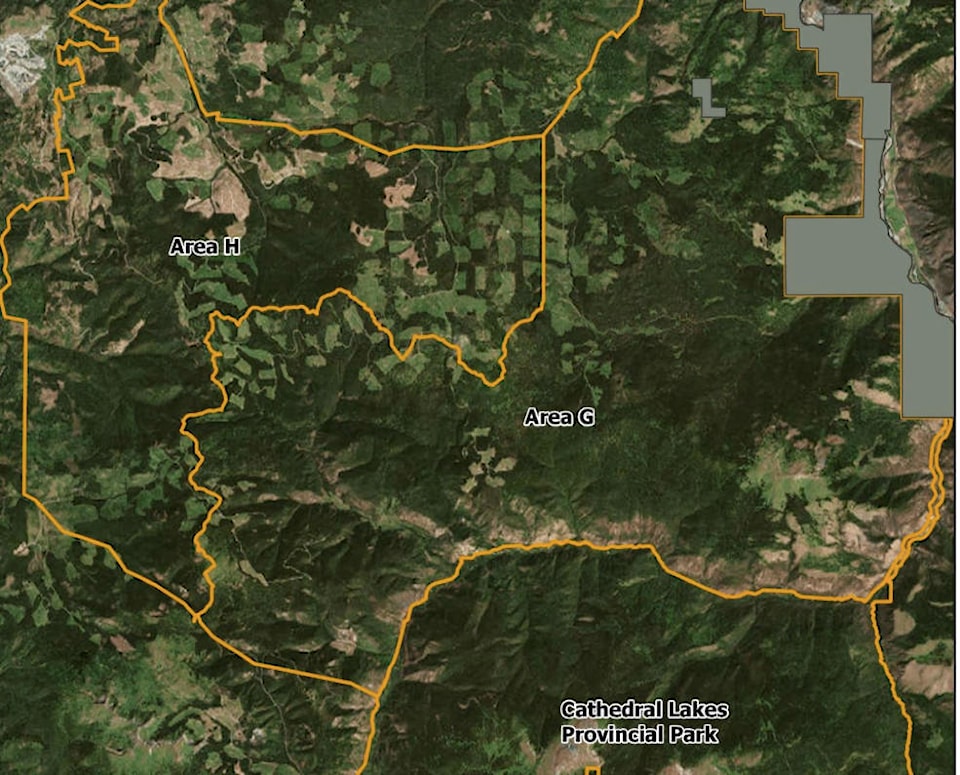
Friday, in response to a significant flare up of the Cool Creek fire, evacuation alerts were issued for properties within the Regional District of Okanagan Similkameen in areas G and H.
Related: Cool Creek blaze near Princeton growing with “extreme fire behaviour”
The Area G evacuation area follows the Ashonola Forest Service Road to the south and east, and the Lower Similkameen Indian Band, Upper Similkameen Indian Band and Sterling Creek Forest Service Road to the north. It does not include private property along Highway 3, nor a portion of Upper Similkameen Indian Band lands identified as Chuchuwayha Indian Reserve 2c.
An evacuation alert was also issued southeast of Princeton in Area H covering lands west towards Highway 3 near East Gate. The evacuation alert boundary remains outside of, and does not include, residential properties along Highway 3 between Manning Provincial Park and Princeton.
An RDOS information release stated: “Specifically, this evacuation alert is of particular importance to ranchers with cattle in the areas identified, as they should begin locating and moving all cattle to a safe area outside of the alert area.”
Related: Snowy Mountain fire travelling away from communities
To report a typo, email:
publisher@similkameenspotlight.com.
andrea.demeer@similkameenspotlight.com
Like us on Facebook and follow us on Twitter.