UPDATE: 10:20 a.m.
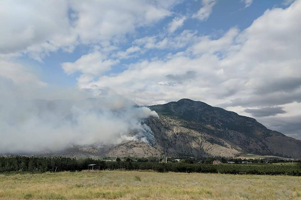
The BC Wildfire Service reports the Snowy Mountain Fire is still 40 per cent contained and was last mapped at 12,039 hectares in size.
“Crews will continue to work to secure the north flank and tie it into rocky slopes in order to keep the fire from wrapping around towards Keremeos,” writes the BC Wildfire Service.
“Other crews continue their work on the east flank to mop-up and patrol along Chopaka Road, and personnel worked to utilize an existing road system in the Roberts Creek area to the south of the fire to develop containment lines and take advantage of existing features. The fire remains to the west of Chopaka Road, but is burning in a southward direction and the south flank and is approximately three kilometres from the U.S. Border.”
The BC Wildfire Service Incident Management Team assigned to the Snowy Mountain Fire is working collaboratively with the U.S. Forest Service, U.S. Bureau of Land Management, and the Washington State Department of Natural Resources given the fire’s proximity to the border.
“The steep terrain is inoperable in some areas, and poses a safety risk to firefighting personnel. Crews are being strategically placed where it is safe and where suppression objectives can be met. Crews are positioned in rotations for 24 hour coverage, working on the south flank to protect communities around where evacuation orders have been implemented. Control lines are being constructed with heavy equipment.”
Fire equipment will be demobilized in some areas where it is no longer required while structural protection specialists will continue to assess properties on the valley bottom, moving south along the Chopaka Road down to the U.S. border.
Currently 106 BC Wildfire firefighters and seven pieces of heavy equipment are actioning the fire.
Eleven helicopters are being used to fight the Snowy Mountain wildfire and the smaller Placer Mountain fire burning about 36 kilometres southwest of Keremeos
—-
ORIGINAL: 7:20 a.m.
Smoky skies are expected in around Keremeos and neighbouring communities this morning as BC Wildfire continues with a planned a burn-off.
“With the support of helicopters, crews began to conduct a burn-off yesterday on the southeast corner this morning, near Chopaka Road. This operation was initiated for the purpose of removing fuels from the slopes adjacent to properties in order to halt the forward progression of the fire. This burn was very successful in helping us with our suppression efforts, and is being continued with this morning to expand along the south flank as of 0600 hrs,” BC Wildfire Service released Wednesday morning.
Wind conditions Tuesday afternoon delayed burn-off plans for the south east corner of the fire.
Related: Update: Wind cancels burn-off plans for Snowy Mountain fire
Fire crews from Mexico, New Zealand and Australia are expected to arrive as early as today to help with the efforts to contain the Snowy Mountain Fire. The fire is 40 per cent contained and was last mapped at 12,039 hectares in size.
Currently 90 BC Wildfire firefighters and nine pieces of heavy equipment are actioning the fire. Eleven helicopters are being used to fight the Snowy Mountain wildfire and the smaller Placer Mountain fire burning about 36 kilometres southwest of Keremeos. The Keremeos Volutneer Fire Department continues to work 12-hour patrols every night watching and actioning spot fires that are started by embers from the Snowy Mountain fire.
| A perimeter map of the Snowy Mountain Fire.The fire is burning three kilometres north of the U.S. border.(BC Wildfire) |
BC Wildfire crews will continue to work today to tie a guard into the north flank using rocky slopes with the goal of stopping the fire from wrapping around towards Keremeos.
Work will also continue on the east flank to mop-up and patrol along Chopaka Road.
The fire remains to the west of Chopaka Road, but is burning in a southward direction and is approximately 3-kilometres from the U.S. border. The BC Wildfire Service is working with the U.S. Forest Service, U.S. Bureau of Land Management, and the Washington State Department of Natural Resources given the fire’s proximity to the border.
Related:Cathedral Lake evacuation order lifted
An area restriction for Crown Land in the area is still in place and several homes are still on evacuation order in the Lower Similkameen Indian Band as well homes in Cawston and Keremeos remain on evacuation alert.
The Snowy Mountain Fire started July 17 when a lightning storm made its way through the region. The same day 22 fires were started in the Okanagan and Similkameen, the majority caused by lighting.
More to come.
To report a typo, email:
editor@keremeosreview.com.
@TaraBowieBC
editor@keremeosreview.com
Like us on Facebook and follow us on Twitter.