The AccuWeather.com spring 2011 forecast for B.C. highlights cold, stormy weather.
The Canadian Spring Forecast team is led by AccuWeather.com Expert Senior Meteorologist Brett Anderson.
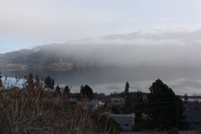
Anderson expects the average storm track this spring to run across southern British Columbia and the U.S. Pacific Northwest to the northern Plains.
With storm systems frequently tracking through the area, precipitation is expected to be above normal. Precipitation will vary between falling in the form of rain and snow, depending on elevation and temperature.
A colder-than-normal forecast for much of Western Canada and the Prairies would favor more snow than rain events at least through the first half of the season.
According to Anderson, southern Manitoba, Vancouver Island and the Maritimes are the areas of greatest concern for spring flooding.
In contrast, the active storm track over southern British Columbia is expected to lead to a drier-than-normal spring farther north toward Juneau, Alaska.
Anderson expects the core of cold air this spring to stay focused over British Columbia and the Prairies with temperatures averaging below normal for the season.
- By Heather Buchman
AccuWeather Meteorologist