Summertime heat in Penticton has arrived two weeks early, according to experts, who are now shifting their focus to the potential for rapid snowmelt as Okanagan Lake water levels continue to rise.
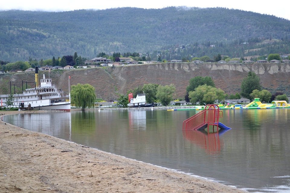
Penticton’s emergency operations centre was activated last week after the lake exceeded full pool due to increased rainfall in the Central and South Okanagan.
As part of Penticton’s response to the increased risk of flooding, the city teamed up with BC Wildfire crews with sandbag operations. A total of 10,000 bags have been prepped for reserve and additional bags have been placed around the city’s Yacht Club which has experienced flooding in the past.
A rainy June seems to be in the rearview mirror, with temperatures expected to stay between a dry 23 C and 33 C through next week.
Any snow that is left will melt fast, said Doug Lundquist, a meteorologist at Environment Climate Change Canada.
June is the Interior’s wettest month of the year and precipitation data from 2022 indicates exactly that. A sudden shift in weather pattern, however, has prompted an additional response from Penticton’s EOC.
“Warmer temperatures are forecast for the start of this week, while sporadic showers remain a possibility,” representatives from the city said on June 20. “Lake levels continue to rise and are expected to for the immediate future.”
“Warm weather was immediately followed by unsettled conditions in the South Interior, which contributed additional precipitation into observed river systems rises,” B.C.’s River Forecast Centre said in a June 15 report.
Though water levels are continuing to rise, Penticton’s EOC says the rate is still well below 2017 and 2020. But rapid snowmelt remains a concern.
“Mission Creek (in Kelowna) has about a third of its average snowpack left, so there will be some snowmelt,” Lundquist said.
“There is still snow in parts of the Southern Interior and I do believe there is a higher-than-average avalanche risk if you’re in the real high terrain.”
The EOC continues to monitor incoming weather and its impacts on the lake, including wave action on the shoreline.
READ MORE: Monitoring for flooding as Okanagan Lake exceeds full pool