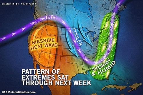
The jet stream will once again become highly amplified (more like a rollercoaster, rather than a flatter, west to east flow) by the end of this week and especially into next week. What does this mean? It means that we can expect another round of extreme weather from west (hot/drier) to east (wet) across the U.S. and southern Canada.
This type of pattern could bring a spell of hot/dry weather into extreme southern interior of BC and then into Alberta next week.