The combination of a slow-moving front and a moist, easterly upslope wind flow will leave the South Okanagan - Similkameen with significant rainfall totals through tonight.
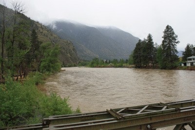
The BC River Forecast Centre issued high streamflow advisories for the Okanagan and Similkameen River tributaries on March 25 after several days of seasonally hot weather led to high snowmelt rates over since Sunday.
High stream flow rates are anticipated to be occurring in smaller, ungauged river systems throughout the region.
Environment Canada is forecasting up to 40 mm of rain through the region over the Wednesday to Thursday period.
Snow melt rates are expected to decline during the passage of this frontal system, however, river levels are expected to remain elevated, or continue to rise, through Friday of this week in response to rainfall. High stream flow and localized minor flooding in low lying areas is possible, and will primarily be confined to smaller watersheds within the region. Flood conditions in medium to larger river systems are not expected at this time.
Highways are reported to be in good condition, with the RCMP detachment in Keremeos noting Thursday afternoo that no serious incidents or traffic problems were apparent in the Similkameen as a result of the heavy rains.