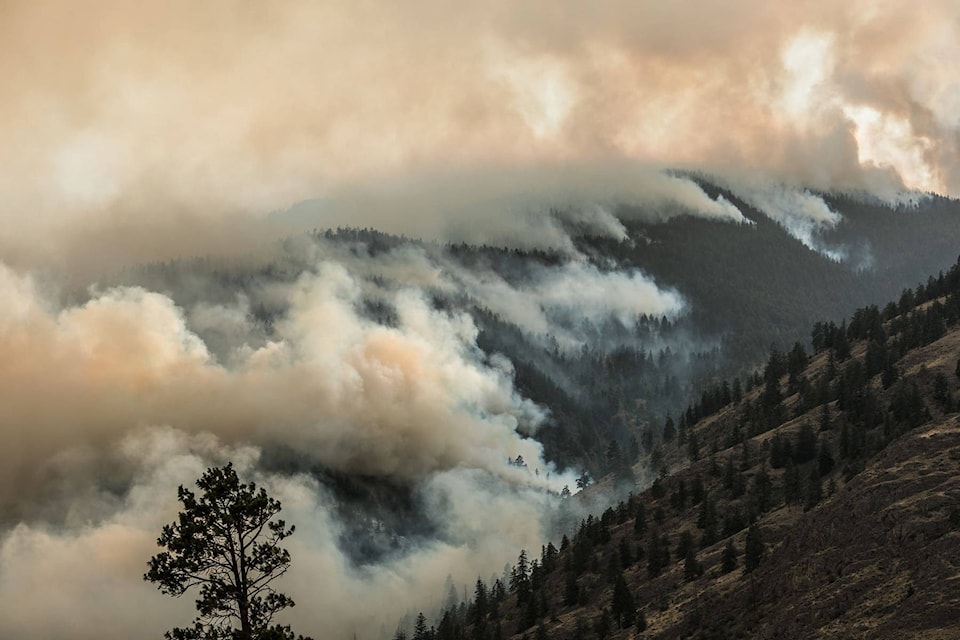
Residents will continue to see the Snowy Mountain fire burn on slopes and atop surrounding mountains.
About 40 BC Wildfire personnel will be working the fire today (Thursday) and air support will be used depending on visibility.
If conditions are favourable, crews could conduct ignition to tie the active fire in to a control line as needed.
Related: Expect to see more smoke and fire on Snowy Mountain
Overnight crews worked to mop up the fire’s edge. Small scale ignitions along the Barrington Creek drainage outlet were successful in tying the control line into the fire at the bottom of the slope.
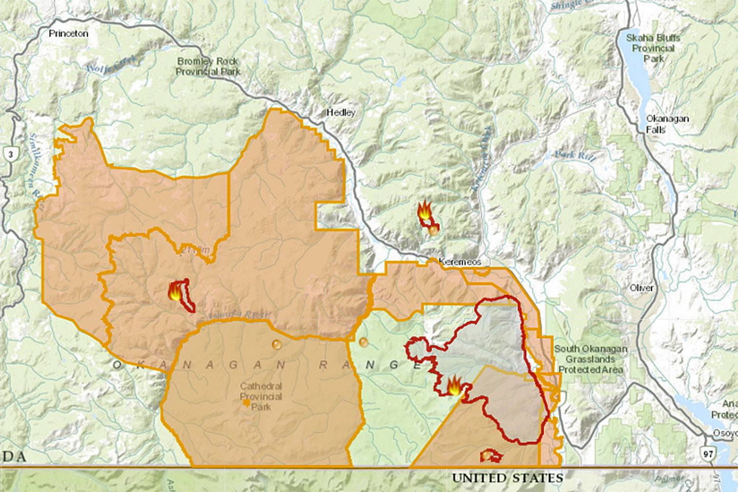
In addition to inoperable terrain, crews are being challenged by debris rolling down the slopes that are on fire. The fire continues to be estimated at 13,359 hectares in size and considered held.
The designation held means the fire is burning within perimeters the BC Wildfire Service has set out.
Rain is forecasted for the South Okanagan and Simikameen and temperatures are expected to be in the teens.
To report a typo, email:
editor@keremeosreview.com.
@TaraBowieBC
editor@keremeosreview.com
Like us on Facebook and follow us on Twitter.